Unveiling Cloncurry QLD: Hidden Mining Trails, Scenic Camp Areas and Thrilling 4WD Adventures. Exploring Cloncurry and beyond.
- Woolgoolgaoffroad
- Aug 4, 2025
- 5 min read

Updated: Feb 13
The Cloncurry region in the heart of Queensland’s outback has alway fascinated me but I’ve never really stopped and dug deep. Explorer Burke and his ill fated expedition passed through back in 1861 when they were racing to the Gulf of Carpentaria. They crossed the Selwyn Ranges at the height of summer which gave Burke great relief as his camels were bleeding and exhausted from the rough terrain, but now they were facing wet season rains and monsoonal heat.

He named the Cloncurry River after a good friend in Ireland and it was after they followed the Cloncurry into the Flinders River that they made their most furthest northern camp, number 119.

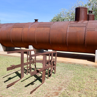
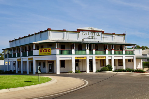
Today it’s a rich mining town, under the shadow of Mount Isa 120 km away with just as much to see and do but without the crowds. The first port of call in Cloncurry for anyone should the Unearthed Visitor Information Centre on the eastern side of town.

Set on several acres there’s plenty to see and do for visitors with mining gear, restored buildings and a great museum to explore inside the centre. The old police station on site was originally miles away at Oona Siding, built in the early 1900’s then pulled down and moved to a small township called Dobbyn out near Mary Kathleen mine. It had a complete referb when it was moved to where it is today and filled with memorabilia from that era.


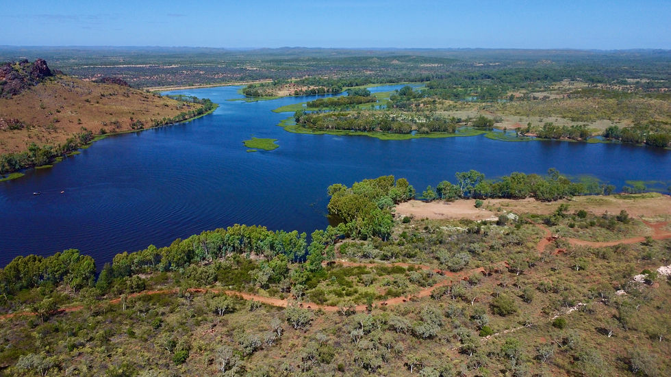
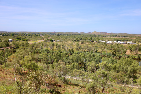
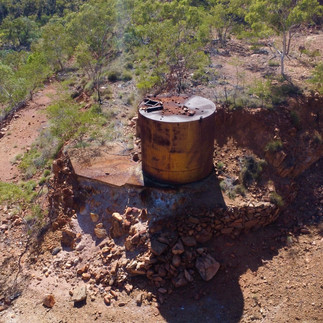
No visiter to Cloncurry can go past Chinaman Dam for a picnic, fish or if you’ve bought a boat here an explore around the dam. A good viewing point to see the town, surrounding area and where the mines are is Chinaman Creek lookout and water tower. It's a great vantage point where you get 360’ views and can read some great town info.
In 1867 Ernest Henry explored the area looking for grazing land, but to his surprise he found large deposits of Copper and today The Great Australian mine that was named after him still produces high grade material. Cloncurry was also the site of a major airforce base during the second world war and it’s where the RFDS was founded in 1928. John Flynn decided on Cloncurry as it was close to mining camps and many pastellist stations, as back in the early 1900’s Cloncurry had the largest cattle selling yards in the North west of Australia. Exploring Cloncurry and beyond in its natural state.


Most people who travel the road between Cloncurry and Mount Isa to the west know about Mary Kathleen, the now closed mining town that was literally auctioned off after the nearby Uranium mine fulfilled its quotas never to reopen again.


Midway between the two towns, it’s located in the stunning Selwyn Ranges when Clem Walton and his mate Norm McConachy found Uranium while prospecting in 1954. Over the years a town was established that catered for families and the working man. When all contracts were filled by 1982, the town was dismantled and sold off, rehab works commenced at a huge cost and won an environmental award for the work that was done.

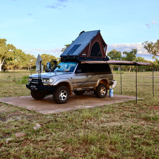


Today, its a free camp where you can literally park on the old house slabs and set up camp for a week to explore the area, plus drive out to the old mine pit which has filled with water. The deep blue colours of the water is a result of the minerals left in the pit and around the edges of the pit tree branches have coralized due to the water properties.

When Mary Kathleen was built, Corella Creek was dammed and became the water supply for the town. South of the town and known as Corella Dam, it’s also a free camping area and known for its good supply of Redclaw and fresh water Crocs where southerners come and stay for months at a time enjoying the serenity and filling their eskies.

Copper was found in the Argylla and Selwyn Ranges and today the Ballara Mining Trail is open to anyone who wants to explore some heritage in the area while getting offroad just up the road from the Mary Kathleen turnoff. Exploring Cloncurry and beyond.
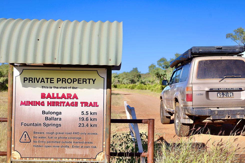
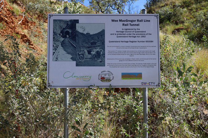
The trail is well signposted to different areas where it’s a good day out exploring the old settlements, rail sidings and operational areas, where some of the 4wd tracks follow the original narrow gauge rail line to the Wee MacGregor Tunnel and the main mining area.

The tunnel is heritage listed and its pretty cool to walk through dodging the colony of bats that live inside. At the other end its an amazing view down to the old mine site, and seeing the rail line twist its way around the mountain where you can still see the hand laid rock walls supporting the line around the rocky ridge-line.


The track down to the Hightville mine is narrow and steep and only possible by high clearance 4wds due to the ravenous damage caused by the storms that happen in the wet season here, but well worth the effort.

It amazes me just how they got the gear down to these places back then, today there would be just too much paper work. Water was a big issue in this area according to the history boards along the way, some years they suspended mining due to lack of water, but then the next year the mines would be flooded creating more issues on just how to extract the water. Some mines just ceased all together in those years.


Left field of the harsh mining areas in the Selwyn Ranges is a little bypass trip out to Fountain Springs waterfall, where this oasis is a sheer relief from the hot sun on any given day. This natural waterhole plays a significant role for the local Kalkadoon people who have lived in this area for decades, where it was a meeting place as well as a vital water source while they hunted through the area.

While Cloncurry might just seem like a quick drive through there’s plenty to see and do before heading in any given direction.
WHERE AND HOW TO GET THERE
Located on the Flinders Highway, Cloncurry is 785km west of Townsville in the heart of Queenslands outback. It’s also the gateway to the Gulf of Carpentaria, just 400km to the north and an hour to the west is the mega mining city of Mount Isa, where most major industries and services can be found.

WHAT TO SEE AND DO
The greater region of Cloncurry has a lot to see and offer. The town itself is surrounded by history plus spend the day at Chinaman Dam just out of town. Maybe head a little further west to camp at either the old Mary Kathleen town site, or maybe Corella dam. There’s the self drive 4wd track to the old mining site of Ballara, walk through the old Wee MacGregor tunnel or visit the Mary Kathleen mine which was once a working Uranium mine pit.


OTHER USEFUL INFO
Cloncurry has a informative tourist information centre and museum on the eastern side of town where not only they can give you a rundown on the towns history but you can also wander around the old buildings on site and other mining relics. They can be found online at www.experiencecloncurry.com . Exploring Corella Dam, the self drive Ballara mining trail and Mary Kathleen is totally free and is located midway between Cloncurry and Mount Isa.


Comments