MOUNT ISA ... explore
- Woolgoolgaoffroad
- Oct 21, 2020
- 7 min read

Mount Isa in outback Queensland, is pretty much a big boring mining town where travellers get their supplies and keep passing through. Am I right ?. Well that’s what I was expecting as we headed towards this outback centre heading towards the gulf.

Now don’t get me wrong, it is a bloody huge mining orientated city where the main mine has been operating since early 1920 right in the heart of town, extracting Copper, Lead, Zinc and Silver for the worlds market.

Mount Isa actually claims to be the largest city in the world as it covers a whopping 43,200 sq kilometres, but in most of this area there’s no population. In fact just over 40% of the towns population someway works within the mining industry and is regarded as one of the most cost efficient mines in the world.

In town there’s a few things to see and do mostly at the Isa Experience Centre where there’s a mine tour, the Riversleigh Fossil centre and the standard coffee and gift shops. Just up the road in Camooweal St you can experience the Underground Hospital and Museum centre where back in 1942 this area was built just in case there was a threat from the Japanese.

To the north of town, the Leichhardt River was dammed in 1958 to provide a guaranteed water source for the town, forming Lake Moondarra where you can picnic, do a bit of birdwatching, slip a boat into the water or simply rest under the shady trees around the shoreline.

The Lake has been stocked with Barra and is a go to place for the locals trying to hook the big one. Once you’ve explored these touristy things and the sunset lookout area that give you views across the city that’s about it, or so we thought.

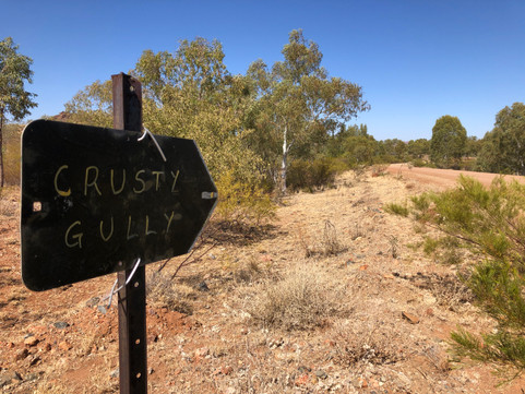

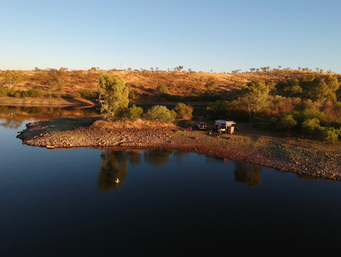
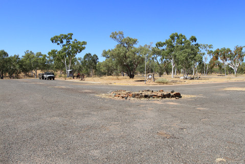
Gathering some info from locals in town we headed east towards Cloncurry along the Barkley Highway for 65km. With a dodgy sign roadside there’s beautiful free camping down beside Corella Dam which was built in 1959 for a nearby Uranium mine that’s now been decommissioned.

Camping around the dam offers stunning water front views in the harsh outback environment that this area is known for. We found that the road in was pretty good and led to the dams boat ramp and where most campers seemed to congregate, but we found with a little exploring and by having a 4wd and offroad camper there’s even better spots if you follow the trails around the dam.

During the cooler months the dam gets pretty packed with southerners getting away from the cold winters down south and chasing the Redclaw that breed here. To the clueless, Redclaw is just a fresh water yabbie, but on steroids, these things are huge if you can catch them.

But you’ll need to read up on the regulations as there are bag and size limits on these mini lobsters. A fun fact after we tried for days to catch some using meat is that Redclaw are vegetarians and just love over ripe fruit and veggies.

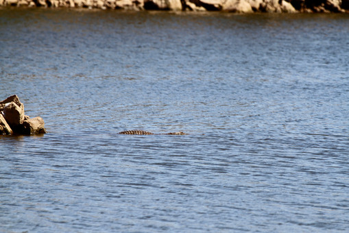
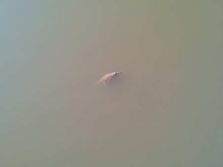
The dam isn’t used for commercial water storage anymore so life around and in the dam is pretty good for the local birdlife and the fresh water crocs that we saw. Apparently it's a go to place for many bird lovers that roam the country looking for different species. We found that the crocs seemed to stay away from the masses and they were best spotted at dawn or dusk in the more remote parts of the dam.


It does make it a bit easier if you have a tinny to explore, but there’s plenty of 4wd tracks around the dam to go searching.

Surrounded by the stunning and ruggered Selwyn Ranges it's hard to imagine that this dam was once the life blood supporting a once a bustling town in the middle of no where. Just 6km away the now abandoned township and mine area of Mary Kathleen has to be seen to be believed.

Back in 1954 uranium was found by accident and over the coming years massive amount of material were excavated from the area and sent overseas. Reports say a staggering 9,000,000 tons of ore was processed through the plant. After years of trying to stay afloat and a few dodgy trade deals the mine closed down in 1982, and even with rehab work there was still corners cut where dangerous materials leached out of claimed safe areas.


Today its all been fixed properly but exploring the staggering open cut mine pus processing areas is just amazing. The buildings are gone now but the infrastructure areas can still be seen where huge concrete pads that once supported massive buildings and tanks are still around.

But its the open cut mine that takes your breath away where staggering amounts of rock has been removed and where you can see the old roads that once circled the mine are still in place. Over the years the mine has filled up with water and the rich mineral based ground has turned it a stunning yet eerie iridescent crystal blue.

Looking into the water its alive with small fish darting in around the trees that look like they have coralized in the water where you can see down some 20-40 feet. But don’t get me wrong, you’d be a fool to jump in - just in case the impurities made you grow another arm or lose your hair.

Interesting that nearby a town was created to support the mine where over 1000 people made a new life and it wasn’t long before there was a school, po, a hospital, halls, shops even a movie cinema were built giving life to Mary Kathleen.

Life was good until the mine closed and subsequently the town died, even after trying to re-open the mine in the early 1980’s. When the mine rehab work was in place the town had to go too, but instead of bulldozing the whole area into a big pit, the towns buildings were auctioned off and taken away. Today the only thing left are the concrete slabs, streets with curb and guttering and several monuments giving homage to those who once lived here, It’s just all gone. Good news is that it's another area where free camping is allowed.


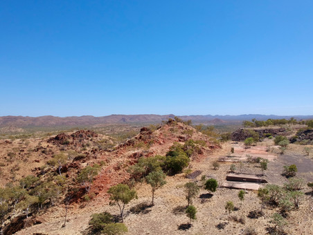
Digging a little deeper we soon found out that this area was thick with other mining interests that pre-dates Mary Kathleen, in fact there’s a mining trail nearby called the Ballara Heritage Trail. Starting midway back to Corella Dam and sign posted right from the start its a pretty cool explore. The road in is pretty easy and stunning with the Argylla Ranges towering over you as you wind your way along.

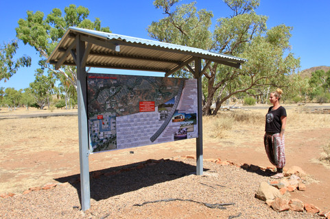
Keep an eye out for the info boards on the way where they’ll explain POI. It's about 20 km along where the old town of Ballara once stood beside, but now just full of passed memories and forgotten dreams.


A walking trail through the ‘town’ leads down to a rail platform where a narrow gauge line ran from Ballara down to the mines almost 40 km away.

Ore was found in the area in 1904 and another rush was on to stake a claim and hopefully become rich, with this came miners, families and infrastructure. At the peak of the boom nearly 1500 miners battled the elements here enduring bloody hot summers, the lack of water and cool winters.

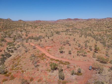


Leaving the old town of Ballara, the road swings westward following and at times on top of the old tramway line. The going gets a little rougher heading this way but its well worth the effort as the road turns to 4wd country dipping down through dry creek beds and over hills following the rough contours of the landscape.

Hand stacked stone bridges, the old ore transfer stage, twisted pieces of steel and rough concrete pylons can be seen on the drive. This was no ordinary tramway as most of the main section was a 3-foot-6 inch gauge but come to the hard, rough and steep sections it was reduced down to a 2-foot gauge to allow more traction.

A lone grave trackside gives homage and respect to a lonely miner that worked in the area and also gave us time out to think just how tough life would of been here. Not far down the track we came across the old settlement of Hightville. Here again there’s not much left, but a POI sign depicts a picture on where there were houses, the local school, a hotel, several mines and explains more history.

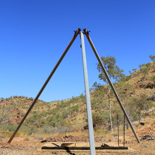
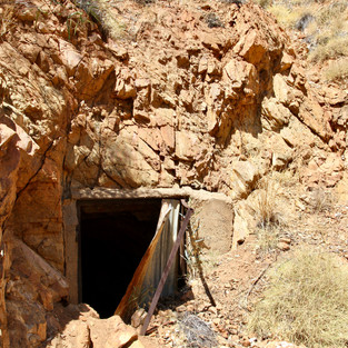
One thing that was highlighted on the info sign was a 100 metre long hand cut tunnel up in the hills. The road is marked as extreme 4wd due to the narrow cuttings, rough terrain and sheer drops along the way, but if you're game its totally worth the effort to find the tunnel.

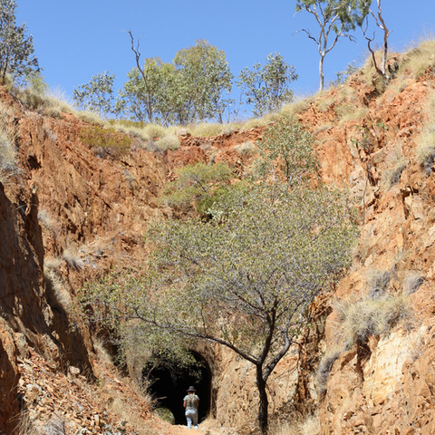

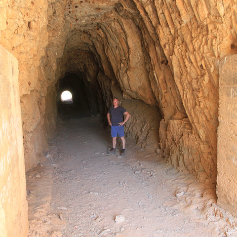
The 100m long, 3m wide and 4m high tunnel was built by a gang of nine men hired on a flat contract rate plus dynamite costs. Thankfully a small rockfall at the entrance doesn’t allow 4wds to drive through anymore but its pretty cool to walk through looking at this amazing piece of engineering. Thankfully there is a heritage listing on the tunnel to preserve its history.

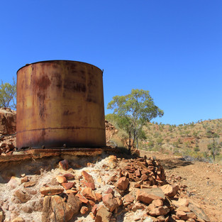
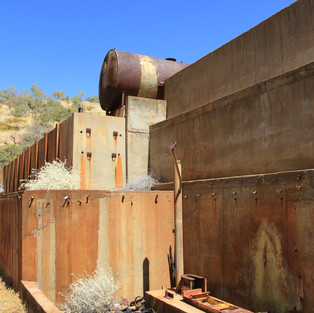
Theres still evidence of pick marks inside, blasting holes, the communication wire still runs through and a few resident Sheathtail bats keep enjoy the cool air inside. Out the other side we viewed the huge Wee McGregor mine workings where it looked like half the hill was moved to extract to copper.

The road down to the mine is also classed as extreme 4wd especially after passed storms had washed part of the road away but walking around the now disused mine area it must of been a bustling area.

Rehab works took place in 1975 but there’s still plenty to marvel at and ponder just how did they get the gear into this severe terrain. Several of the deep ( read nearly 100 metres down ) mines have had safety grates welded over the top but looking down into them certainly gave me vertigo.

It was a tough few years in the area where the tramway line took most of 1914 to complete, then mine work was suspended in 1916 due to lack of water, then in 1917 the area was hit with extremely heavy rainfall causing flooding and damaging the line. Sadly in late 1917 the mine was closed due to diminishing mineral finds.


Some of the gear was solid off and the men paid out. Over the next few years the line was pulled up and the Wee McGregor loco ended up on a cane farm.


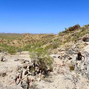

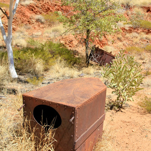
Throughout the area between Mount Isa and Cloncurry across the stunning and often harsh ranges, there’s a host of mines and related history dating back before the Mount Isa deposit was found. Random and isolated lone graves, open mine pits, tunnels plus relics from days gone by, part of our pioneering history that thankfully is being protected for years to come.


Comments