


THE PLENTY HIGHWAY. Is it really a horrid outback track ??

The Plenty Highway is one of Australia’s great iconic dirt shortcuts, but slowly, it’s being sealed to make cutting across the country just a little easier for tourists, locals and haulage.

Kicking off roughly 70km north of Alice Springs from the Stuart Highway, it carves its way eastward until it hits the Queensland border, from here the name changes to the Donohue Highway eventually terminating at Boulia, nearly 250km away.
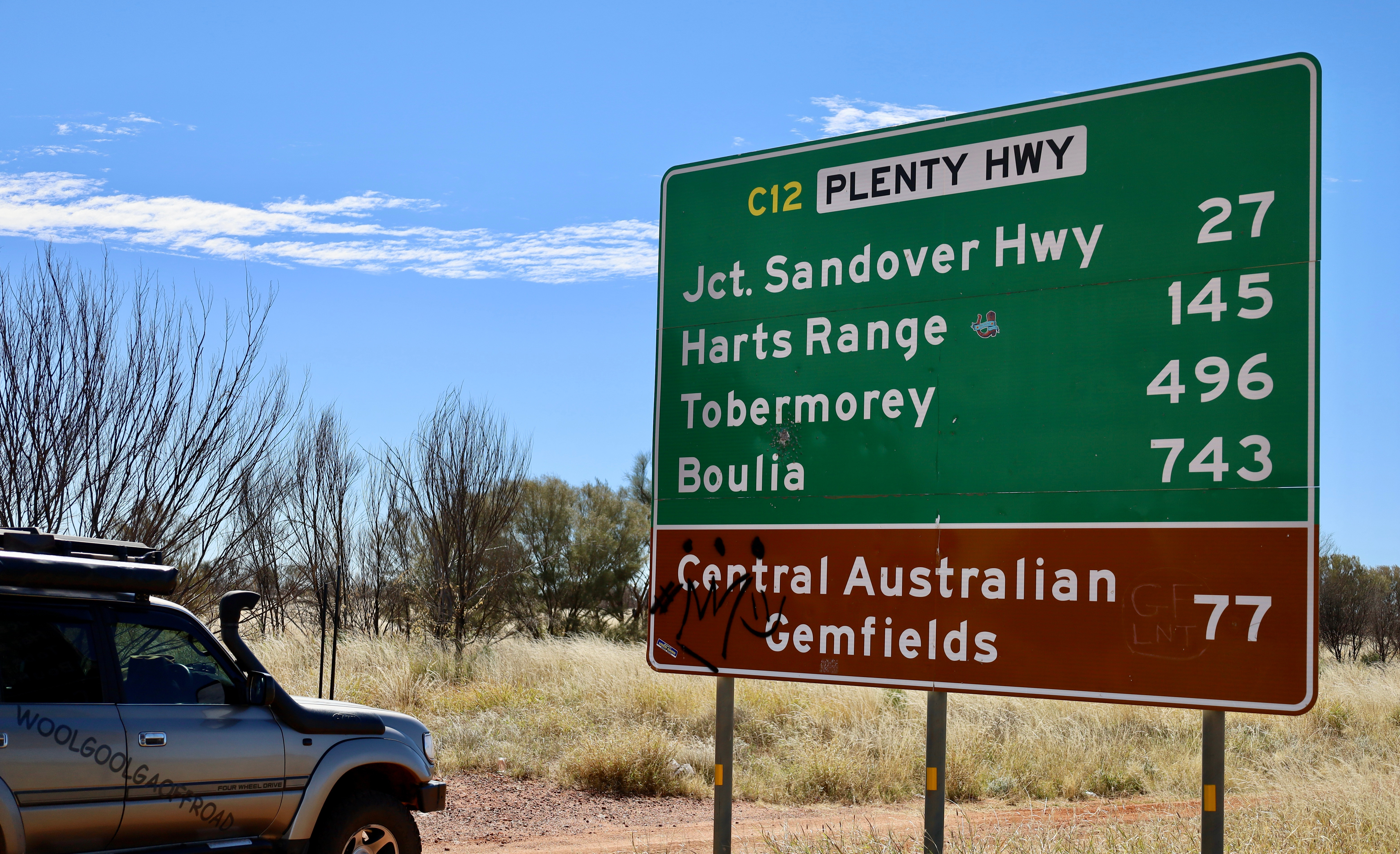
It’s celebrated as a critical section of the Outback Way, a massive 2,700-kilometre tourist drive known as Australia’s Longest Shortcut, which links Laverton in WA to Winton in QLD.

The Plenty, as it’s commonly called, has a rich and colourful history that’s evolved from thousands of years of Indigenous pathways into a rugged stock route, a mining lifeline and now one of Australia’s most iconic outback 4WD adventures. Long before vehicles arrived, the corridor was travelled by Aboriginal people, specifically the Eastern Arrernte for thousands of years.

Along with the Eastern Arrernte people, there were the Alyawarra and Anmatyerre people who had traditional lands to the north, descendants still live on country today and used these routes for trade and ceremony, navigating by ancestral songlines. Their intimate knowledge of the land including how to find water in what appears to be completely dry riverbeds was vital to the survival of early European explorers who later mapped the area.

The highway takes its name from the Plenty River, an ephemeral watercourse that runs parallel to the road for nearly 200 kilometres, the river was named in 1878 by explorer Henry Barclay while surveying the arid region. Barclay dug into the dry riverbed and struck a massive, seemingly endless flow of water, marvelling at the fact that there was "plenty" of water to go around in such a harsh environment, the name stuck.

During the late 19th century, European settlement expanded into Central Australia, where the route became an informal stock track used by pastoralists to move massive herds of cattle between remote Northern Territory stations and the railheads in western Queensland.

In the late 1920’s, the discovery of rich mineral fields in the Harts Range particularly for mica and copper dramatically shifted the need for better infrastructure. Small-scale miners needed to transport heavy machinery and tonnes of mined materials out of the desert. This economic boom forced the government and locals to clear a track capable of handling trucks, transforming it from a simple stock path into a commercial transport connection. Eventually it was up graded from a station track and formally gazetted as a highway in 1966.

It’s been a decade since I traversed the Plenty and back then it was it had a fierce reputation among 4WD communities for its brutal corrugations and deep bull-dust holes plus the entire length was nearly unsealed. The highway is currently undergoing its biggest historical shift, a major government-funded project to progressively seal the entire route with bitumen. Already sealed the first 170km to Atitjere plus random sections along the Plenty.

My first stop was at Gemtree Caravan Park about an hour along the Plenty which is like a true oasis in the scrub. Set across 250 acres of natural bushland, this family-owned park serves as the perfect staging post for any Plenty Highway expedition. At Gemtree, you can choose between a powered site or an unpowered bush camping spots. The unpowered sites are cleverly cleared into the natural mulga scrub, giving you a distinct sense of privacy and isolation without sacrificing creature comforts.

Gemtree runs popular guided tag-along fossicking tours to their private leases where you pack your 4WD and follow the guide out into the bush to be shown roughly where to look and what to do. If fortune smiles you’ll see a brilliant flash of deep crimson garnet or a sparkling, glass-like zircon sitting proudly on top of the dirt. Best of all, Gemtree features an onsite gem-cutter who can assess your finds and cut them into shimmering, brilliant-cut jewels right before your eyes, plus their pies are to die for.
Further east is the Mud Tank Zircon Fields where self contained campers can set up and dig for gems. It’s here that the Binns Track runs north-south past the fields heading into more isolated country.
For nearly 200km and rising 1,000 metres above sea level to the south of the Plenty is Harts Range, a rugged, spectacular mountain range that’s a geological wonderland boasting steep ridges and deep valleys heavily rich in pegmatite veins. Harts Range has a long, history of mica mining dating back to the late 19th century. Today, it stands as a premier public fossicking region where rockhounds can seek out an astonishing variety of minerals, including Garnets, black Tourmaline, Beryl, and smoky quartz crystals, but just make sure you have your NT fossicking permit and not digging on private property.

A short drive past the community of Atitjere, swing north and head up the Arapunya Road to the Boxhole Meteorite site that was discovered in 1937 when Joe Webb a shearer at Boxhole Station took geologist Cecil Madigan to check it out. The crater is 170 metres in diameter, with the rim rising about 20m above the crater floor, it’s believed to be about 5,400 years old. Located on Dnieper Station homestead, it’s well sign posted and visitors are welcome to access through the station to see the dent in the ground.
Travelling further east along the Plenty, the landscape transitions into vast expanses of open cattle country and deep desert open areas leaving the stunning mountain range behind. For those undertaking the full cross-border trek between Alice Springs and Boulia, there’s two iconic cattle stations that provide a sanctuary stopover with fuel and camping along the route, namely Jervois and Tobermory Station.

Jervois serves as a mid-way stopover on the Plenty for many travellers, offering fuel (both diesel & unleaded), basic snacks and ice during daylight hours. The camping at Jervois is a raw, no-frills bush camp set against the stark beauty of a working pastoral lease. The grounds feature basic unpowered sites, clean toilet blocks and hot showers powered by a traditional donkey hot water system.

There are no manicured lawns here you camp on the natural red earth surrounded by skeletal desert oaks and the hum of station life. Just outside the gates of Jervois, is the start of the Hay River Track, a tough remote isolated track that’s for experienced 4wders.

Situated a further 210 kilometres east right on the cusp of the Northern Territory and Queensland border, lies Tobermory Station, a historic, family-operated working cattle station covering over a million acres that offers a completely different atmosphere to the rugged terrain found further west.

Arriving at Tobermory feels like discovering a hidden sanctuary where the campground is beautifully maintained, boasting lush, green grassy lawns shaded by large, mature trees, a luxury that feels incredibly indulgent after driving through hundreds of kilometres of red dust and corrugations. Tobermory offers fantastic facilities, including spacious unpowered campsites, cabins, immaculate amenities with piping-hot showers, camp kitchen and communal fire pits where travellers gather to swap road conditions. '

They have several walks around the station grounds and the Tobermory Bar with a unique fire pit on the back of an old truck. The station store is stocked with cold drinks, basic groceries, souvenirs, and fuel. Sitting on the grass with a cold beverage as the sun dips below the flat border horizon is an essential Plenty Highway ritual.
Once leaving Tobermory and crossing into Queensland, it’s a mundane run eastward towards Boulia, but not before crossing the huge Georgina River flood lands where surprisingly the road has large sections of it already sealed. There’s free camping beside the Georgina and a couple of interesting info boards describing the water flow and history of the area. Quite often when huge rain events occur or there’s cyclonic activity in the Gulf of QLD, the Georgina has massive flood events where the water flows further south into the channel country making it impassable.

Years ago, the Plenty was regarded as a challenge with its rough conditions through isolated & remote areas, but today with the road being sealed it's an absolute essence of an out-back trek from the gemfields of Harts Range to the warm hospitality of remote station stays.

Today, it feels delightfully remote, yet it holds a rich tapestry of pastoral, mining and Indigenous history just off the main track where the landscape is a striking canvas of deep red earth, golden spinifex plains and sharp mountain ridges cutting across the horizon. Crossing the Plenty forces you to slow down, by looking closely at the earth beneath your feet, appreciating the raw wild beauty when cutting through the centre. For some heading out looking for glittering gems in the dirt is their goal, but the real treasure you'll take home is the memory of the red dust, campfire stories and that wide endless outback horizon.
WHERE IS THE PLENTY
The Plenty Highway is an outback dirt road located in Australia’s Northern Territory and acts as a vital route across the red centre serving as a major link between Central Australia and western Queensland. Spanning approximately 498 kilometres from its western starting point to the Queensland border & onto Boulia in Outback Queensland, via the Donahue Highway.

WHAT TO DO AND SEE
Along the Plenty Highway you can begin your journey by fossicking for garnets and zircons and stay at Gemtree Oasis Caravan Park, a premier wilderness gem-hunting spot. As you drive further east, marvel at the dramatic ridges of the Harts Range through to open desert areas. The trip offers a true taste of pastoral life with stops at working cattle stations like Jervois and Tobermory, where you can camp under brilliant, unpolluted starry night skies. Along the way, there’s also the chance to head up and explore the Boxhill Meteorite Crater, tackle some of the infamous Binns Track and spot unique desert wildlife near seasonal riverbeds.
IMPORTANT INFO
Work is underway to seal the whole of the Plenty Highway, currently there’s nearly 150km completed from the NT side, and intermitted sections along the way, travellers need to check road conditions. Seasonal rainfalls can shut the road real fast and as the whole area turns to slop. There is free camping near the fossicking fields for self contained campers. Places such as Gemtree Caravan Park offers powered and unpowered bush sites, fuel, food and can be contacted on 08 8956 9855 or via their website, www.gemtree.com.au.

Pastoral stations Tobermory ( 07 4748 3280 ) and Jervois ( 08 8956 6307 ) also offer camping and fuel. The community of Atitjere has a general store, fuel facilities and emergency services if needed. For road condition updates check both NT and QLD roads website. The best time of year to visit is during the cooler months, April to October, as summer temps can be unbearable. The longest distance without fuel is 245km between Boulia and Tobermory Station.


Comments