THE GWYDIR ... regional NSW
- Woolgoolgaoffroad
- Jun 11, 2020
- 5 min read

Updated: Jun 12, 2020
Back in 1827 Allan Cunningham came through the Gwydir River area and camped beside the river with his entourage as they headed north looking for new pastoral land. Over the next few years things more people followed and subsequently Bingara was officially founded in 1840.

With most new settlements locals started searching the outlying areas and gold was found and a few years later along with other gems like Rubies, Garnets and a few diamonds. Not long after the word got out about another new goldfield the towns population grew, shops and pubs were built along with a police station, post office, flour mill and much more. The gold and diamonds soon ran out about 1950 and the miners, families and shop keepers moved on. At the time the Bingara diamond field was Australia’s largest and most profitable with the largest one found being 37 000 carats.

These days it’s a quiet slow town where travellers are welcomed and the locals are friendly with advice and have big hearts. On our arrival we headed straight to the local Tourist info centre for some advice on where to stay and what to do. The local council have set aside areas in the heart of town where you can free camp beside the Gwydir river and further east towards the massive Copeton Dam. Being an ex mining town Bingara has set aside areas where you can freely fossick for different gems and thankfully the Info centre can give you a map where you can go. One of the biggest gold mines ( and the last too close just before 1950 ) in Bingara was the All Nations mine and with this the stamper was saved. Minutes from town in Hill Street you can get up and personal to the massive 10 head stamper that was used in the mine. Fully intact you’ll be blown away with the size of this thing, but just for a minute stop and think about the logistics re getting this monster out here from England.

Back in town, one of there best places to get an overall view of town is the Batterham Lookout on the eastern side of town. The narrow road leads you up several hundred metres to some of the best views of the area. You can make it a day out up here as there are toilets, bbq’s and one of the many bird walking trails in the area. These days the town has had a refurbish to an art deco feel in eluding the fully functional Roxy theatre built back in the 1930’s. Bingara sits in a valley surrounded by several ranges including nearby Mount Kaputar ( an old volcano active 20 million years ago ), so weather conditions vary immensely from winter to summer. Frost is a common occurrence during Winter but that’s the best time to throw another log on the fire and enjoy the clear Winter skies. Summer time is often hot and dry with 4 million flies being a pain so come prepared or just spend time in the nearby pool or the Gwydir River cooling down.

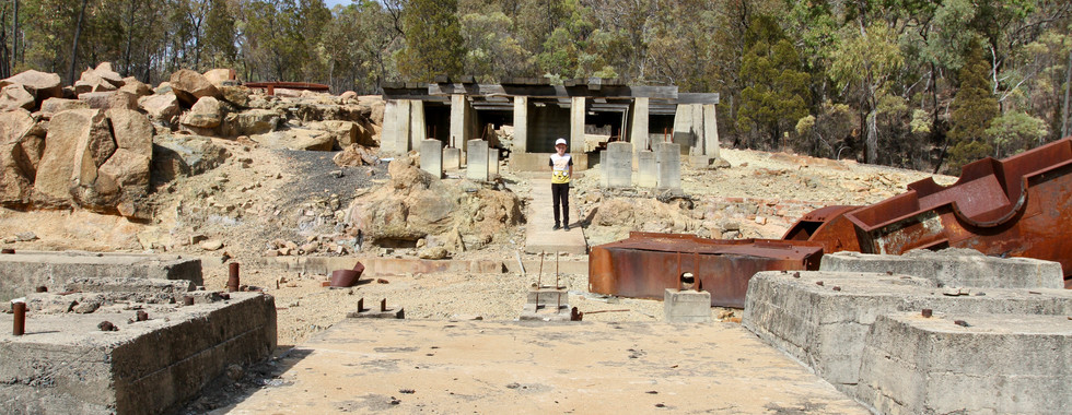
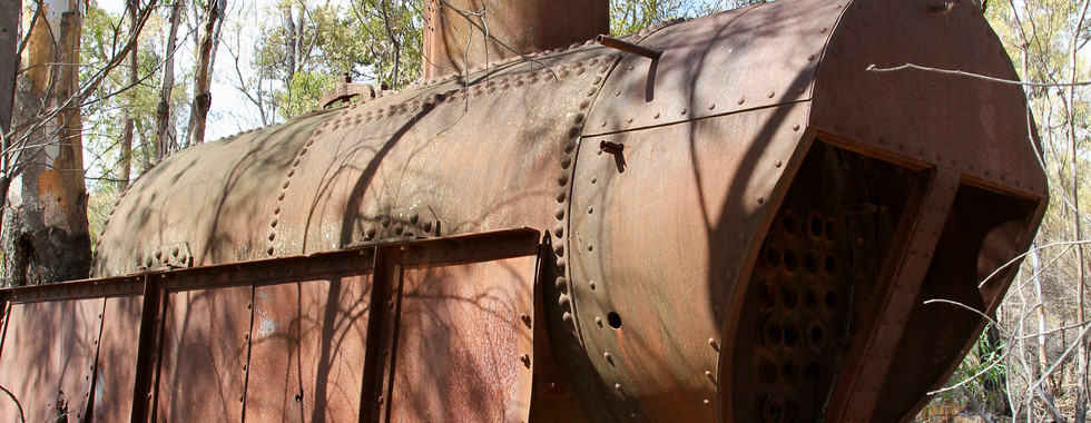
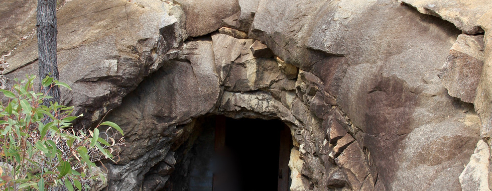
Further east towards the massive Copeton dam there are areas that can only be explored by 4wd. Copeton dam allows for free camping and holds some of the biggest Cod in the state. At the turn of the century before the dam was a thought there were massive mines in the area, including several Arsenic and tin deposits. One of the more notable ones was the Conrad Arsenic mine that has now been decommissioned where rehabilitation works have taken place. It’s pretty darn amazing to be able to wander around this area gazing at the incredibly massive and solid timber structures that once lowered the workers deep into the mine in steel crates. Around the mine area there’s just a lot of relics that have been left behind that include structures, boilers, concrete foundations and just so much more. Down the main mine road towards Copeton dam, keep a look out for the tunnel in the rock where the explosives were kept behind a thick steel and timber door keeping them at a steady and cool temperature. There’s a series of tall solid rock structures that ran cable carts away from the mine to dispose of the waste rock and around the hills you can see other mines and tunnels, some even have narrow trolley rail lines coming out of.


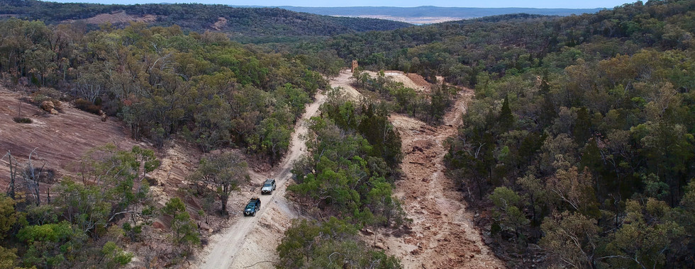


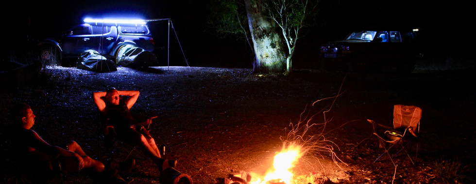
Some of the better and more remote camping can be found nearby at the Gwydir River conservation area. Here the area has been broken into several sections but one of our favourites is the Salmon section below Copeton Dam. Entry is via the Inverell to Copeton Dam road through a nature corridor where sheep properties line either side. Not a hard road ( allow an hour to travel the 20 km ) into the area best for most 4wds with proper low range but recommendations advise not to tow any kind of trailer down into the gorge area. The gorge road winds its way down pretty steep towards the bottom with plenty of switchbacks and narrow sections. Along the way take a break at the Boulders lookout where the views across the valley towards other Tor's and mountains are some of the best in the region. But just keep in mind that there is absolutely no mobile reception out here so safety first and stay back from the edges.


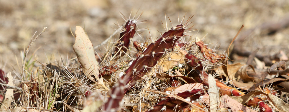
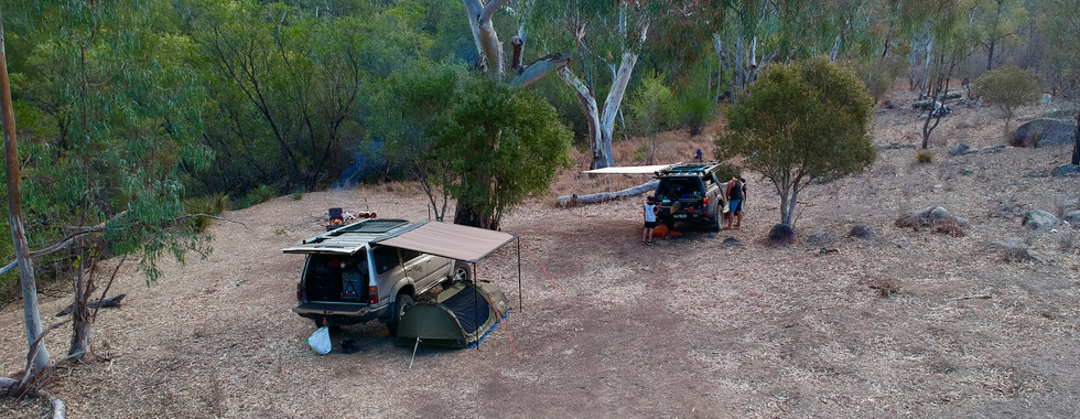
The terrain is steep and holds nearly no flora content apart from the Cyprus Pines that like this sandy soil in amongst the granite rocks. It's not until you get down the bottom of the gorge where the land flattens out a bit you’ll see more native grasses and gums. This area is also the home to several types of deer ( although we saw none ), feral pigs and roos. Right at the end of the track where it merges with the Gwydir River the camping spots are too die for with water views and lots of flat areas for a swag or tent. The river has a sandy base where the water is filtered to the max giving crystal clear water to soak in on those hot days. Along the river there are loads of Bottlebrush and other native flowering trees where the birdlife soak up the area due to plenty of insects and water to survive.

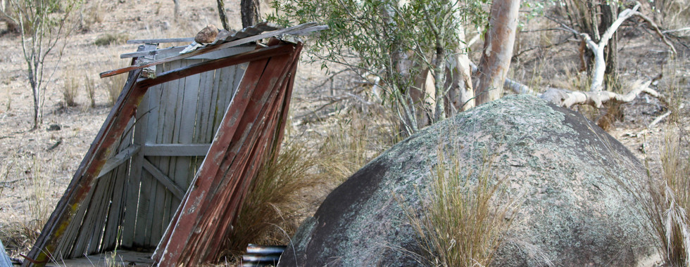
Back in the day this area must of been popular as pit toilets were installed but these days they are full of rubbish and are seriously leaning over about to collapse - to us it looked like there had been no maintenance for years on these structures. The Gwydir River region is on the cusp of the New England area where the summers get extremely hot but then the winters get down below zero so the best time to head here would be either Spring or Autumn where you’ll have the cooler nights and warm days.

Throughout the area there are plenty of huge granite boulders and over the past millions of years they have been slowly breaking down due to wind and rain depositing a sandy covering across the area. During periods of heavy rain these little ball bearing type grains of sand become pretty slippery so take care in the area when exploring if a sudden storm covers the area. Once down here in the gorge there’s no other 4wd tracks so its a great place to unwind and enjoy the river with its natural beauty. The Gwydir River region may not be as popular as other higher profile destinations in the area but if your after something more out of the way, remote and need to switch off this spot will tick your boxes. It’s all about the history, hidden camping areas and relics that line this great area.


Comments