Unveiling Historical Tambo and the Breathtaking Wilderness Way to Springsure in Central QLD
- Woolgoolgaoffroad
- Aug 6, 2025
- 5 min read

Updated: Feb 13
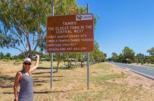
Tambo in central Queensland is one of those places where most people zip through giving no thought on past history or local attractions. I’ve been through Tambo a few times and honestly I thought it was just another quiet country town. Unveiling Historical Tambo

Surprisingly, Tambo is the oldest town in Central Western Queensland when a settlement began in 1863 and it became an important stopover for drovers as they passed through
looking for new pastoral blocks. Prior to explorer Sir Thomas Mitchell who was in the area in 1846 following local river systems, the Dharawala Aboriginal people roamed the area.


When the area was settled, the town was originally called Carrangarra but was changed to Tambo in 1868, the towns pub still carries the original name that was built in 1865. The pub has burnt down three times over the years and once served as the local post office. Over the next 50 years the town boomed with infrastructure to service the area and today Tambo boasts a huge pastoral industry and along side a growing tourism trade.

Tambo is located on the Barcoo River 860km north west of Brisbane in central Queensland and its a beautiful place to spend a few hours exploring the historical buildings, wandering around the towns dam, enjoying the Coolibah Walk, spending time in the transport museum and discovering Tambo Teddies.

The visitor information centre has a brochure that allows visitors to explore 17 historical buildings in Tambo with informative information on each building. Just on the edge of town is the local dam, constructed in 1880 and was the towns water supply until 1895 until bores tapped into the Great Artesian Basin. Today the dam is alive a multitude of different birds, fish and insects endemic to the area.


Today, many people know about Tambo Teddies, a local brain storm that started in 1992 when wool prices crashed and there was a need to sustain new energy and economy into the town. Roll on 33 years and the staff at Tambo Teddies estimate they have sold over 50,000 Teddy bears around the world.


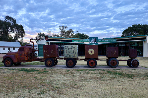
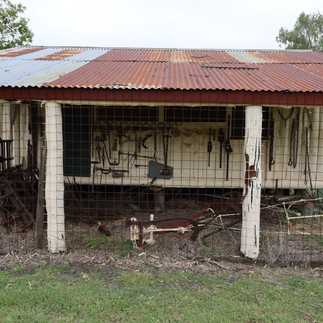
Just down the road is the Wild and Woolly Tambo Truck and Transport Museum that was sculptured in 2012 to highlight when wool was king. Originally a 1944 freight truck owned by local trucking company, Johnson Brothers, the truck and trailers have been cleverly built using reclaimed material gathered from the area.

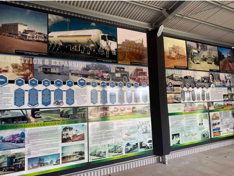
The museum is jam packed with memorabilia related to the towns long history with transport and the generations of families that have kept the outback moving. It also showcases the evolution of transport from the horse-drawn carriers of the 1860s to the early motorised trucks of the 1920s and today’s modern fleets.


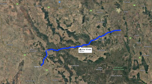
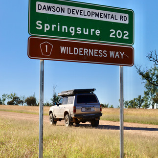
After spending a few hours in town I found a great scenic 4wd adventure called The Wilderness Way that links Tambo to Springsure 250km away. My starting point was 40km north of Tambo at the locality of Windeyer where the Dawson Development Road turns right and where the dirt starts.

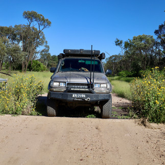
When I read about the Wilderness Way it was recommended that its only suitable for high clearance 4wd’s, but to be honest the roads were darn good and I seriously couldn’t see where you would need high clearance.

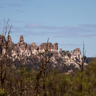
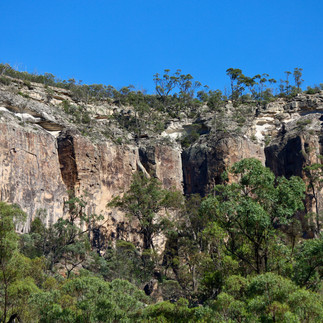
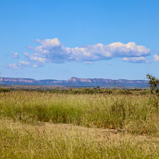
It’s a self drive tour on the western side of Carnarvon Gorge and Salvator Rosa National Park where for most of the journey there are spectacular views of massive cliff lines, rock formations and vast areas of ruggered mountains.

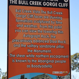
Midway along a good stop is at the Bull Creek Vista lookout area. Looking eastward there are towering sandstone rock formations called Autograph and Stool Rock plus a solitary pillar aptly named The Monument.


Another hour up the road and at the intersection of Cungelella Road, there’s a monument to Major Thomas Mitchell for when he passed through this area in 1846 trying to solve the mystery of Australia’s river system and if we did have an inland sea. It was Mitchell that named the nearby Salvator Rosa valley after a famous Italian painter.

He also named the Claude River plus found one of the richest pastoral plains ever discovered which he named Mantuan Downs, and while crossing the plains Mitchell discovered entire petrified trees. While in the area he continued to the east and discovered the Belyando and entire Barcoo River system.

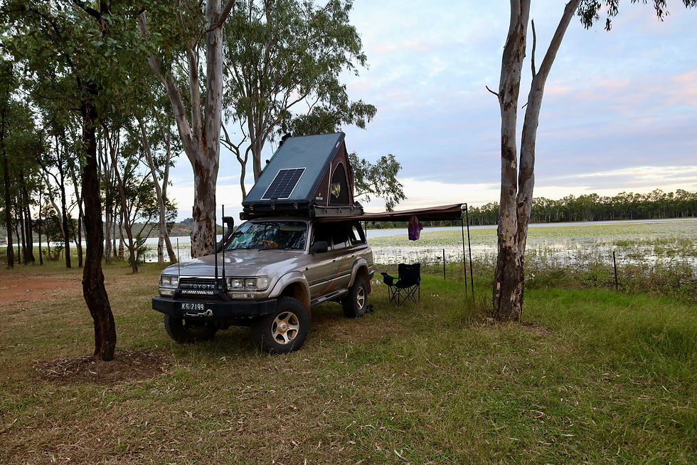
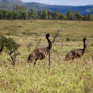
Cungelella Road leads you out to the remote Salvator Rosa NP where you can enjoy isolated camping, remote hiking and enjoy the array of wildlife in the area. If you do hike in this remote area, Queensland Parks ask you to fill out the Remote Bushwalking advice form and leave it with a responsible person due to the areas sheer ruggedness and inhospitable countryside. An interesting feature of the park is that the clear springs add more than ten million litres of water a day to the nearby creeks as they seap under the Central Queensland Sandstone Belt and into headwaters of creeks and rivers.
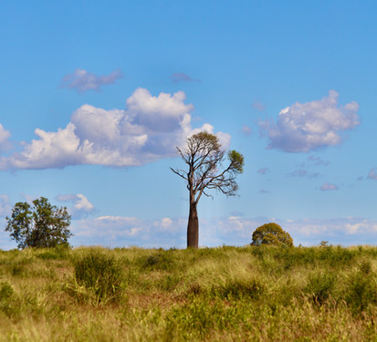
Heading back along the Dawson Development Road towards Springsure, the countryside opens up to rolling pastoral land and to where the majestic Bottle Tree’s are scattered across the hills.


It’s not long before Springsure comes into sight where there’s a stack to see and do from natural wonders in the Minerva Hills National Park where you can see old volcanic plugs and activity, there’s the Springsure museum that’s jammed packed with local memorabilia dating back 150 years or even camp under Virgin Rock and see it lit up at night.


Now while I have only touched the surface of this stunning area between Tambo and Springsure there’s so much more to discover from natural wonders, living museums of cultural history and some of the best remote roads that central Queensland has to offer.

WHERE
Tambo’s Wilderness Way is a remote self drive road either done as a 270km loop or an adventure drive between Tambo and Springsure in central QLD. The trek can be done with a SUV but 4wd is recommended especially after rain as the track may become impassable. Tambo was settled in 1863 and is the oldest town in western Queensland and is a town of living museums and cultural history. Tambo is located 580km west of Bundaberg on the Landsborough Highway.


WHATS AROUND
Tambo’s main street is lined with historical buildings, a transport museum and the oldest pub in western QLD. The Wilderness Way drive that heads out of Tambo is known as the ‘Rooftop of Queensland’ where travellers will be amazed at the amount of deep gorges and vast cliff lines. Sharp sandstone ranges are the highlight on the drive in the Salvator Rosa NP. Depending on your adventure you can camp in the National Park, keep heading towards Springsure or do the loop back to Tambo. When in town, don’t forget to drop into the well known Tambo Teddies, where they have been making cute teddies since 1993.


MORE INFO
The main street of Tambo is alive with its history with info boards at nearly every historical building. The Outback Queensland website has basic self drive information for the drive, or call into the Tambo Museum for more detailed info. They can be found at 10 Arthur Street for all things history in the area. For more info check out https://www.outbackqueensland.com.au/town/tambo/


Comments